
Navigation
Install the app
How to install the app on iOS
Follow along with the video below to see how to install our site as a web app on your home screen.
Note: This feature may not be available in some browsers.
More options
Style variation
You are using an out of date browser. It may not display this or other websites correctly.
You should upgrade or use an alternative browser.
You should upgrade or use an alternative browser.
PNW Flood Watch - Dec 8-12, 2025
- Thread starter Evan B
- Start date
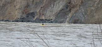

Don't really care if they want to risk their life for a few highwater thrills, but doing so when emergency services are already maxxed out aiding other folks is beyond selfish.Darwin candidate!
View attachment 174478

Replicant
Life of the Party
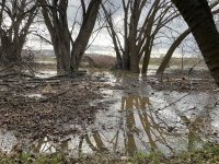
By no means a big deal, but I thought I would share. I dropped my daughter off at school this morning and it was 66 degrees. Fortunately the wind finally died down. fifty mile an hour gusts were getting annoying, but I didn't lose any trees. However, I'm slowly losing acreage down here on the lower Yak. We are now at a minor. In theory, I should be seeing some major flooding on my property by tomorrow night. Highly unlikely that we will get water near any structures, but I can't say the same for my neighbor. Might be a long night.

Yep, no sympathy for those that take away resources during times like these. I get the adrenaline thing and I know kayakers target high water, but there's so much debris in the river it's completely foolish...and selfish.Don't really care if they want to risk their life for a few highwater thrills, but doing so when emergency services are already maxxed out aiding other folks is beyond selfish.

Idaho is having issues as well.
SF
 www.krem.com
SF
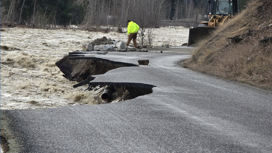
Bonner County Road and Bridge declares county-wide flood emergency
Some people, including Bonner County Commissioner Ron Korn, say it's the worst flooding they've seen in decades.
www.krem.com

Paige
Wishing I was fishing the Sauk
Yep, no sympathy for those that take away resources during times like these. I get the adrenaline thing and I know kayakers target high water, but there's so much debris in the river it's completely foolish...and selfish.
The kayakers I know are up in the little creeks dropping waterfalls during these events.

Stay safe, everyone. Us older west coasters used to call these super-wet events a "pineapple express" because the temperature was unseasonally warm. "Atmospheric river" sounds more dramatic, I guess.
I found a very informative news site from your side of the Canada-US border:
https://www.cascadiadaily.com/2025/...acuation-nooksack-river-at-cedarville-crests/
That report mentioned flooding from the Nooksack River flowing from the Sumas, Washington area, into B.C.'s Sumas Prairie, which is a large, low-lying farming area between the border and the mighty Fraser River. That reminded me of a video that I had saved from the infamous flooding in fall 2021. It's shot from a helicopter flight, from high ground in the lower Fraser Valley, eastward, bringing food to people stranded in Hope. At that point, all roads in and out of Hope were closed, and even between the Lower Mainland (southwest B.C.) and the rest of B.C. Around 4 or 5 minutes into the 18 minute video, you can see just how massive the flooding was in Sumas Prairie. I can just imagine how much water was also on your side of the border that fall. So far this time, there's not quite as much flooding in the area for us, but it sounds like this storm has been hitting you folks in Washington very hard. Hang in there as best you can.
I found a very informative news site from your side of the Canada-US border:
https://www.cascadiadaily.com/2025/...acuation-nooksack-river-at-cedarville-crests/
That report mentioned flooding from the Nooksack River flowing from the Sumas, Washington area, into B.C.'s Sumas Prairie, which is a large, low-lying farming area between the border and the mighty Fraser River. That reminded me of a video that I had saved from the infamous flooding in fall 2021. It's shot from a helicopter flight, from high ground in the lower Fraser Valley, eastward, bringing food to people stranded in Hope. At that point, all roads in and out of Hope were closed, and even between the Lower Mainland (southwest B.C.) and the rest of B.C. Around 4 or 5 minutes into the 18 minute video, you can see just how massive the flooding was in Sumas Prairie. I can just imagine how much water was also on your side of the border that fall. So far this time, there's not quite as much flooding in the area for us, but it sounds like this storm has been hitting you folks in Washington very hard. Hang in there as best you can.
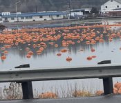
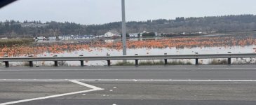
Saw these on another site. The hatch is definitely on!
SF
SF

True story
Back in the 80's a company I worked for bought a lot of topsoil from Carpinitos. They got behind in payments, and old man Carpinito punched the owner of the company in a rather heated meeting...more than once we heard

Owner came in the next morning looking like he got his ass beat.
Back in the 80's a company I worked for bought a lot of topsoil from Carpinitos. They got behind in payments, and old man Carpinito punched the owner of the company in a rather heated meeting...more than once we heard
Owner came in the next morning looking like he got his ass beat.

Washington is not the only state affected;

 nbcmontana.com
Gianforte declares flooding disaster in northwestern Montana
Gov. Greg Gianforte has issued an executive order declaring a flooding disaster in northwestern Montana.Since Dec. 8, the Fisher and Yaak Rivers have experienc
nbcmontana.com

What happens when flood guages get overcome and submerged? Like how do you measure that?
That might not be salvageableDo pumpkin fry out migrate immediately like pinks and chums?
Anyone lose a blue kayak near Hwy 2?
SF
View attachment 174398

A lot of it is Doppler and hydroacoustic equipment that can withstand submersion provided whatever they’re affixed to doesn’t wash away. Depending on the site and the parameter and the tech being used, they may need to be recalibrated afterward, if the river changed in the flood.What happens when flood guages get overcome and submerged? Like how do you measure that?

Yeah I was gonna say... This is pretty standard procedure for the whitewater kayakers.The kayakers I know are up in the little creeks dropping waterfalls during these events.
If it was a drift boat, then yeah, RIP, buddy.

Breck
The Whisk(e)y Dick
Washington is not the only state affected;
Gianforte declares flooding disaster in northwestern Montana
Gov. Greg Gianforte has issued an executive order declaring a flooding disaster in northwestern Montana.Since Dec. 8, the Fisher and Yaak Rivers have experienc
I saw that same post today. Not looking good for the town of Libby.
Yeah, it's the same everywhere. I have friends that live in Arkansas that are white water junkies, they can't wait for the next flood.The kayakers I know are up in the little creeks dropping waterfalls during these events.
 But usually they run in packs and have their own support crew and ability to self-rescue.