
Navigation
Install the app
How to install the app on iOS
Follow along with the video below to see how to install our site as a web app on your home screen.
Note: This feature may not be available in some browsers.
More options
Style variation
You are using an out of date browser. It may not display this or other websites correctly.
You should upgrade or use an alternative browser.
You should upgrade or use an alternative browser.
PNW Flood Watch - Dec 8-12, 2025
- Thread starter Evan B
- Start date


the_chemist
Life of the Party
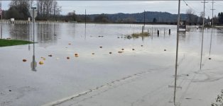
Lower spawning humpkins are actually an introduced strain from bc and cut white. Nice to see they are making good use of the pilchuck.I personally only keep the wild humpkins that cut a bright orange.
Last edited:

Anyone know how far back the recordkeeping goes for the Skagit and Snohomish gauge level records that are in danger of being broken? Trying to get a sense of where this potential flooding really stacks up historically against some of the anecdotes being shared here.
Clicking the Snohomish river gauge USGS info, looks like daily gauge height data goes back to 1998, and continuous monitoring starts in 2015. But I can’t tell if there’s info further back or when the existing record height was set.
Thanks!
Clicking the Snohomish river gauge USGS info, looks like daily gauge height data goes back to 1998, and continuous monitoring starts in 2015. But I can’t tell if there’s info further back or when the existing record height was set.
Thanks!

The Skykomish goes back to 1929 per the header on the NW River Forecast page. I would imagine the snoho is the same or similar.Anyone know how far back the recordkeeping goes for the Skagit and Snohomish gauge level records that are in danger of being broken? Trying to get a sense of where this potential flooding really stacks up historically against some of the anecdotes being shared here.
Clicking the Snohomish river gauge USGS info, looks like daily gauge height data goes back to 1998, and continuous monitoring starts in 2015. But I can’t tell if there’s info further back or when the existing record height was set.
Thanks!

Lower spawning humpkins are actually an introduced strain from bc and cut white. Nice to see they are making good use of the pilchuck.
View attachment 174397
Do pumpkin fry out migrate immediately like pinks and chums?
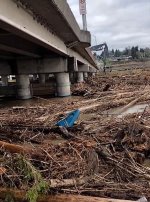
Anyone lose a blue kayak near Hwy 2?
SF

They spawn in the late fall and early winter, then out migrate right after the first big rains.Do Humpkin fry out migrate immediately like pinks and chums?
View attachment 174398
There's still some late run spawners near me, but I can see them headed for the creek, and out into the bay.


Paige
Wishing I was fishing the Sauk
Skykomish at 99k cfs now! Hopefully it is cresting.
It's looking to be slowing down a bit on the gage, and not raining as much here in Gold Bar.

Yard Sale
Life of the Party
Definitely going to be landslide activity this winter. More heavy rain coming next week. So much for the drought.
Good call for the coast. Unfortunately for us a bit east it was 60 degrees on the mountain this morning. Our "snowpack" is going backwards... If we don't get a big spring its going to get really dry out here this summer. Not great for our anadromous friends.
According to USGS peak flow records -Anyone know how far back the recordkeeping goes for the Skagit and Snohomish gauge level records that are in danger of being broken? Trying to get a sense of where this potential flooding really stacks up historically against some of the anecdotes being shared here.
Clicking the Snohomish river gauge USGS info, looks like daily gauge height data goes back to 1998, and continuous monitoring starts in 2015. But I can’t tell if there’s info further back or when the existing record height was set.
Thanks!
The station on the Snohomish near Monroe goes back to the 1964 water year (beginning in October of 1963)
The station on the Snoqualmie near Carnation started in 1941
The two stations on the Sauk also began in 1929.
The Skagit near Concrete began in 1925
On the Skagit there are some estimates of peak floods at concrete significantly larger than the1995 estimate of 160,000 cfs.
There are 3 estimates between 1888 and 2021 between 210,000 and 265,000 cfs.
There is an estimate from 1856 of a peak flood of 340,000 cfs and one from 1815 where there was a gigantic event of 510,000 CFS (state height of 69.30 9established from flood scars on trees above the river.
Curt

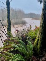
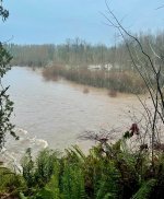

A moderate La Nina is forming, so the cold and snow is coming.Good call for the coast. Unfortunately for us a bit east it was 60 degrees on the mountain this morning. Our "snowpack" is going backwards... If we don't get a big spring its going to get really dry out here this summer. Not great for our anadromous friends.


ThomasM
corvus ossifragus
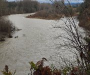
A little spicy on the Sol DUc but seems like the north coast didn't get hit as hard this time. Calawah already crested at 13.9K and it looks like the Sol Duc will crest soon at less than 28'.
I've been watching the camera on the back deck and talking to my neighbor to make sure I didn't need to make a mid-week flood mitigation run but no worries this time. Back in Nov of '21, it got high enough to come up through our basement which was a bummer for me being up all night with a bilge pump and a bucket trying to prevent our furnace from getting swamped (have an electric pump now, lesson learned).
Right now: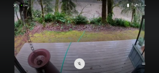
"Good fishing" levels in winter about 20' on the gauge.
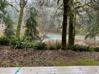
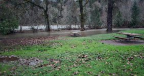
November '21 - in the photo above, the smallest of the three trees in a row in the middle of the frame is the same tree in the video below for reference. Calawah was over 40K and the sol Duc was at 33'.
I've been watching the camera on the back deck and talking to my neighbor to make sure I didn't need to make a mid-week flood mitigation run but no worries this time. Back in Nov of '21, it got high enough to come up through our basement which was a bummer for me being up all night with a bilge pump and a bucket trying to prevent our furnace from getting swamped (have an electric pump now, lesson learned).
Right now:
"Good fishing" levels in winter about 20' on the gauge.
November '21 - in the photo above, the smallest of the three trees in a row in the middle of the frame is the same tree in the video below for reference. Calawah was over 40K and the sol Duc was at 33'.
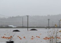
The latest Skagit flood level update (4:15{M) is getting very scary. The forecast is for levels 4.89 feet higher at Mt. Vernon Friday morning than the modern-day record.
Perhaps even more worrisome is the length of time the river is expected to remove at or above major flood levels. It looks like the model has the river maintaining those levels for about 2 days. The concern is that with that kind of pressure that there could be some dike failures. Hope the heck the models are wrong.
Those in the Skagit Valley and elsewhere are in my thoughts.
Curt
Perhaps even more worrisome is the length of time the river is expected to remove at or above major flood levels. It looks like the model has the river maintaining those levels for about 2 days. The concern is that with that kind of pressure that there could be some dike failures. Hope the heck the models are wrong.
Those in the Skagit Valley and elsewhere are in my thoughts.
Curt