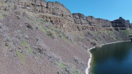
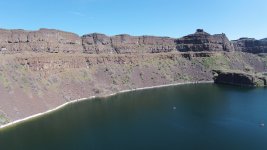
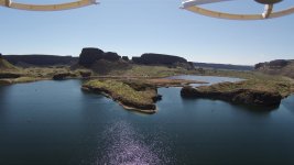
FWIW, getting water from montana to cataclysmically flood over dry falls takes some leaps in fluid dynamics and logic. The Montana-dry falls theory works like this:
Right around Brewster pool the okanogan lobe of ice blocked off the columbia, essentially creating lake roosevelt 15000 years ago. Water from Missoula comes crashing through rathdrum and mostly follows the Spokane river, plowing into ice age lake roosevelt. The lake swells and eventually oversteps at banks lake, creating the upper and lower grand coulee.
The problem with this two fold. Firstly, if lake roosevelt is in existence, why would water entering it in spokane not drain through the lower elevation notches along the columbia east of banks lake?
Secondly, how do you explain the water maintaining the velocity it needs to scour dry falls as it allegedly did after running into a lake. Nick zentners flood video shows essentially unimpeded, sediment laden flood waters crashing over dry falls. I dont think thats possible.
Even if dry falls is the best outlet for a flooding lake roosevelt, the lake would have taken out the velocity and sediment before it overtopped. Dont get me started on moses coulee, which has no direct connection to the columbia, much less montana.
The work being done on the pre-Missoula carving of coulees is fascinating. Missoula is a sexy story and played a big role, but the creation of eastern Washington's scablands is so much bigger than that.



 washingtonstategeology.wordpress.com