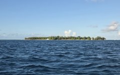
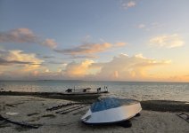
Part 1: Mauritius – Star and Key of the Indian Ocean
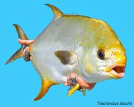
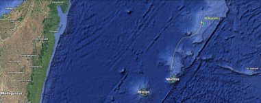
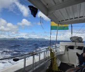
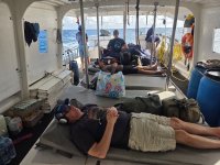
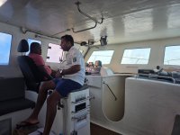
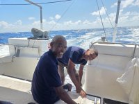
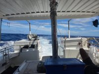
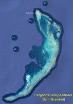
During every trip there is a moment where feelings of regret and remorse take over. I’m overwhelmed with it now, staring out over the stern of the supply ship Albatross from an open air throne of bean bags. My eyes, stinging with salt spray, scan for an indiscernible horizon over the inky black swells of the open Indian Ocean. Then a burst of spider lightening illuminates the malevolent cloud mass of a fast approaching thunder cell. Another discharge violently fractures the night sky, and I hear the engines revving higher. The captain must have noticed the storm from the bridge, but the glowing nimbus still gains on the boat as though pulled along with a kite string. What in the hell am I doing out here? Breathing deeply, I remind myself that some destinations have to be earned by another level of risk and suffering. Just get through this and the fishing will be incredible. The boat slices into rolling waves toward a chain of remote islets that rise up from the Mascarene Plateau to form a wilderness saltwater fly fishing sanctuary blessed with prolific populations of tailing gamefish. Among these are the crown jewel of the flats, the Indo-Pacific permit, and bonefish and trevally species of exceptional proportions. I shut my eyes and force myself to relax by revisiting the memories of my last few days on land traversing the big island. Mauritius, that’s where it started.
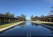
A secluded beach resort on the southern end of Mauritius near Bel Ombre
Mauritius, Réunion, and Rodrigues were each spawned by volcanic activity from a hotspot under the Indian Ocean crust. Grand peaks and spires of basalt rise above sea level creating lofty mountain chains, and abundant rainwater feeds lakes within the basins of dormant calderas. When first encountered by the Portuguese and later the Dutch in the 16th century, Mauritius was a heavily forested tropical paradise devoid of humans. Introduction of swine, monkeys and rats ensured the rapid demise of native species, most famously the dodo bird. Over harvest of tropical hardwood trees was followed by introduction of sugar cane and tea plantations in need of intensive labor. The human population grew and diversified with the grim advent of slavery and later indentured servitude. Devastating cyclones collapsed the Portuguese and Dutch colonization attempts, but the key geopolitical position of Mauritius between Africa and India was again exploited by the French and British in the 18th and 19th centuries. Warfare, slavery, and piracy faded into memory by the Victorian era and Mauritius quietly developed into a key economic hub in the Indian Ocean. Now a fully independent republic, Mauritius is remarkable for the peaceful coexistence of its Hindu majority, African, Muslim, Tamil, Chinese, and European inhabitants. The real intrigue of this island is the rich mixture of cultures and religions intermingled in the splendid isolation of the Indian Ocean.
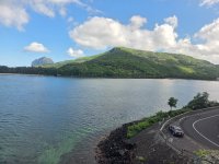
The southern coast of Mauritius with Le Morne Brabant mountain (upper left)
Arriving at the airport terminal in Plaine Magnien I was grateful to find a taxi, my legs stiff from 22 hours flying. The driver set course for the sleepy southwest corner of Mauritius, leaving behind a throng of sweating Europeans bound for tourist hubs Grand Baie in the north or Flic en Flac in the west. The road took us past vast sugar cane fields for miles. Dilapidated long houses built for the field workers and their families were a reminder of the harsh existence of the indentured servants whose cheap labor drove the sugar export business. The dark outlines of the “pyramids of Plaine Magnien” stood out in the distance. These carefully constructed step pyramids are a monument of thousands of unwanted basalt boulders removed from the tilled soil of the fields. The road emerged onto the ocean at the rugged beaches of Souillac on the extreme southern end of the island and hugged the coast. Long public beach parks alternated with small towns whose businesses and markets cater mainly to the local population. The stone spire of a Catholic Church may precede a green Muslim mosque or a yellow Tamil temple, while a red Hindu shrine waits just down the road. Mauritian Creole is the unofficial language uniting the many ethnic groups, but English works well enough to transact simple business. After an hour, the taxi reached the hidden beachside hotel near the town of Bel Ombre. That night, I fell asleep to the pulsating rhythms of a marathon outdoor Sega dancing performance.
My first excursion on Mauritius was to hike up Le Morne Brabant mountain to view the ocean reefs and surrounding forested peaks. Le Morne Brabant is one of two UNESCO world heritage sites on Mauritius and its story will touch anyone who values human freedom. For many years runaway slaves (maroons) sought refuge on the high slopes of the mountain and in its caves. When the British declared an end to slavery in 1835, police were sent to Le Morne Brabant to inform the former slaves of their emancipation. Tragically, the maroons feared the police had come to arrest and re-enslave them. They climbed up the steep slopes of Le Morne Brabant where many jumped from the cliffs to their deaths.
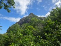
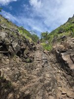
The trail leading to the peak of Le Morne Brabant transitions from shaded forest to exposed chutes of sun scorched basalt.
My hike began at a shady beach near the remains of an abandoned Creole village. The rocky trail climbed through thick forest with ample fruit trees to feed the birds and monkeys. Looking up through a gap in the forest I could occasionally see the summit towering above me like an impregnable medieval Cathar fortress. Eventually the path emerged out of the forest onto several flat ledges with viewpoints of the saltwater flats and coral fringing reef far below. A battered yellow sign listed multilingual warnings about proceeding further, and a chain linked fence funneled hikers to the steep summit path. I stashed my water bottle into a rock crevice to keep my hands free for the climbing scramble ahead.
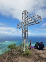
The monument to runaway slaves who escaped from the plantations of Mauritius.
The climbing wasn’t overly strenuous, but the biggest challenge was maneuvering around other hikers ascending or descending the steep chutes of slippery basalt. The mid-morning sun was rapidly heating up the rock faces and I kept moving before it became a furnace. Near the top I negotiated the Hillary Step of Le Morne Brabant, deftly moving up the more rugged right side of the ascent to get past a dozen other hikers. I knew I had achieved the summit when a metal cross monument and Mauritian flag appeared before me at the edge of a narrow outcropping. Panoramic views of nearby Black River Gorges National Park and the Le Morne “underwater waterfall” pouring through a gap in the outer reef were truly spectacular. I made some friends by volunteering to take group photos for fellow hikers, mostly young travelers on holiday. Dark clouds gradually closed in on the summit and I needed to get off the mountain before the rock became too slick with rainwater.
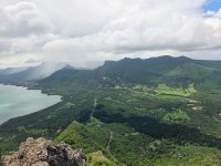
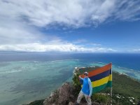
Stunning views from Le Morne Brabant include the outer coral reef and famous “underwater waterfall” optical illusion.
The next morning, I packed up my gear and hired a driver to tour southern Mauritius. His name was Anwar, a Muslim with a passion for hiking and horticulture. Ramadan was almost over and with the first sighting of the crescent moon, the Eid al-Fitr holiday would be declared on Mauritius. “It only takes two Muslims to observe the moon and Ramadan is ended,” Anwar explained. “Eid will be celebrated tomorrow with feasting.” He was amazingly energetic and talkative for a man who had been fasting for weeks. We left the coast and drove up into the surrounding hills toward the mountain community of Chamarel. The surrounding terrain looked remarkably similar to parts of the Hawaiian Islands and French Polynesia. Chamarel waterfall cascades over a vertical cross section of lava flows accumulated over eons during the island’s volcanic formation. The neighboring Seven Coloured Earth formation was a dazzling visual display of light courtesy of an array of iron and aluminum oxides formed by the chemical weathering of lava rock. As sun and cloud shifted in the sky, the colors intensified or dimmed against the contrasting green forested mountains.
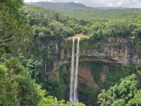
Chamarel Falls
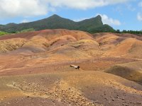
Chamarel Seven Coloured Earth geologic attraction
We continued our drive into the mountainous interior, entering Black River Georges National Park. This rugged nature reserve contains the largest area of undeveloped forest in Mauritius and is home to endangered native bird, animal, and plant species. Magnificent views of mountain peaks, immense forested valleys, and waterfalls stretch out to the ocean. Black River Peak, the tallest mountain on Mauritius at 828 meters, was within reach following a steep 3 km trail. Unfortunately, I only had time to walk a short section of the swampy trail to get a sense for this tropical forest ecosystem. I was impressed to learn that the Mauritians have an avid hiking and trail running tradition. Anwar explained that he had summited all of the major peaks on the island and would be hiking with family members soon now that his Ramadan fasting was over.
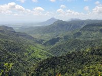
Black River Gorges National Park
The spiritual nexus of Mauritian Hindus is a natural crater lake called Grand Bassin or Ganga Talao, which has been developed into a large temple complex. Local Hindus believe the lake waters are connected to the sacred Ganges River by an underground stream. Every year in late February or early March, a massive pilgrimage to Grand Bassin occurs during the Maha Shivaratri (Great Night of Lord Shiva). Visitors are greeted from a distance by towering thirty-three meter statues of the goddess Durga and Lord Shiva. The multi-lane road leading into the temple area is impressively wide to accommodate thousands of pilgrims making the journey on foot. “Young men race their cars here at night,” Anwar told me. “If you drive fast enough the car will fly into the air where the road dips.” He was less impressed with the religious significance of the lake and its connection to the Ganges, but did find tales of Shiva’s amorous liaisons entertaining.
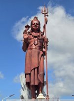
Hindu deity Shiva at Grand Bassin
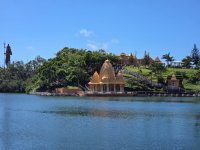
Grand Bassin lake and temples
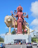
Hindu goddess Durga at Grand Bassin
My minimal familiarity with the Hindu faith left me feeling bewildered by the number of gods and goddesses in human or animal form. Some deities could also take the form of a holy trifecta, which added to my confusion. And all those extra arms wielding objects of mysterious symbolism! The shore of Grand Bassin was lined with ornate sculptures and statues of the major Hindu gods. Worshippers placed before them offerings of fruit and prayers were lifted on the smoke of incense. Cynomolgus macaque monkeys lurked nearby waiting to seize the unattended bounty, snarling at any clumsy tourist that approach too closely. Mauritius is overrun with these mischievous monkeys, and they are occasionally culled or sold abroad to biomedical research laboratories. Bad karma. The sacred waters of the lake are alive with many species of fish, eel, and freshwater turtles. These cruise at the water’s edge, nibbling on rice and coconut meat discarded into the lake.
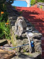
A temple cynomolgus macaque monkey eating flower blossoms. Perhaps we’ve met before in another life?
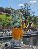
Hindu deity Ganesha at Grand Bassin lake, the remover of obstacles and god of new beginnings.
It was time to head toward my new hotel in the capital city Port Louis. Anwar drove north up the central plateau to his neighborhood in Curepipe while he pointed out his favorite varieties of fruit trees growing along the streets and courtyards. Houses here are built like fortresses with high walls, presumably to withstand the force of tropical cyclones. In late February 2025, Cyclone Garance passed near Mauritius and made landfall on neighboring Réunion where it killed four people and caused substantial damage. The Mauritius Meteorological Services Doppler Weather Radar Station, located at nearby Trou aux Cerfs volcanic crater, is a colossal forty-three meter concrete tower necessary for tracking the tropical storm threat. The heavily forested crater of Trou aux Cerfs is also a popular walking park in Curepipe with excellent views of surrounding mountains and the Indian Ocean.
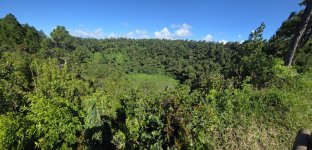
Trou aux Cerf volcanic crater at Curepipe, doppler weather radar tower in the background.
The smooth highway and Metro Express light rail system leading north from Curepipe to Port Louis demonstrate that this urbanized portion of Mauritius has the features of a fully developed nation. The mirrored glass towers of Cyber City high-tech office park reflect the country’s desire to be the major technology hub in the Indian Ocean. A commodity based big sugar economy has been replaced by textiles, financial services, tourism, and luxury real estate development. Unfortunately, many local residents are struggling to find a place in the new economy as high inflation puts strain on their modest annual incomes. Meanwhile, outsiders have flocked to Mauritius for an affordable retirement or to build luxury homes in a scenic and secure part of the world.
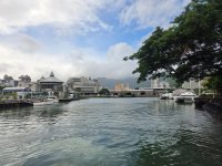
Port Louis waterfront leading into Victorian era warehouse buildings.
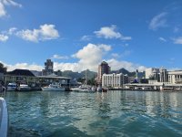
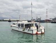
Anwar delivered me at my hotel on the Port Louis marina, and I genuinely appreciated his verbose and enthusiastic introduction to his island home. I tracked down my fly fishing companions at the outdoor bar, all of them very experienced travelers and anglers. It wasn’t long before our conversation turned to the dreaded boat crossing. Despite the Eid al-Fitr holiday, the supply boat would be able to buy fuel in the harbor for our trip. More importantly, the weather report sounded reasonable. I had one more evening to enjoy the benefits of air conditioning and the simple comforts of modern living. The final leg of the voyage to Saint Brendan’s Island would begin in the morning.
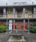
The Blue Penny Museum in Port Louis is home to stamp collecting’s holy grail: the Mauritian “Post Office” stamps of 1847.
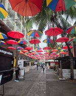
A Port Louis street on the morning of the Eid al-Fitr holiday
Up Next: The Crossing
During every trip there is a moment where feelings of regret and remorse take over. I’m overwhelmed with it now, staring out over the stern of the supply ship Albatross from an open air throne of bean bags. My eyes, stinging with salt spray, scan for an indiscernible horizon over the inky black swells of the open Indian Ocean. Then a burst of spider lightening illuminates the malevolent cloud mass of a fast approaching thunder cell. Another discharge violently fractures the night sky, and I hear the engines revving higher. The captain must have noticed the storm from the bridge, but the glowing nimbus still gains on the boat as though pulled along with a kite string. What in the hell am I doing out here? Breathing deeply, I remind myself that some destinations have to be earned by another level of risk and suffering. Just get through this and the fishing will be incredible. The boat slices into rolling waves toward a chain of remote islets that rise up from the Mascarene Plateau to form a wilderness saltwater fly fishing sanctuary blessed with prolific populations of tailing gamefish. Among these are the crown jewel of the flats, the Indo-Pacific permit, and bonefish and trevally species of exceptional proportions. I shut my eyes and force myself to relax by revisiting the memories of my last few days on land traversing the big island. Mauritius, that’s where it started.
A secluded beach resort on the southern end of Mauritius near Bel Ombre
Mauritius, Réunion, and Rodrigues were each spawned by volcanic activity from a hotspot under the Indian Ocean crust. Grand peaks and spires of basalt rise above sea level creating lofty mountain chains, and abundant rainwater feeds lakes within the basins of dormant calderas. When first encountered by the Portuguese and later the Dutch in the 16th century, Mauritius was a heavily forested tropical paradise devoid of humans. Introduction of swine, monkeys and rats ensured the rapid demise of native species, most famously the dodo bird. Over harvest of tropical hardwood trees was followed by introduction of sugar cane and tea plantations in need of intensive labor. The human population grew and diversified with the grim advent of slavery and later indentured servitude. Devastating cyclones collapsed the Portuguese and Dutch colonization attempts, but the key geopolitical position of Mauritius between Africa and India was again exploited by the French and British in the 18th and 19th centuries. Warfare, slavery, and piracy faded into memory by the Victorian era and Mauritius quietly developed into a key economic hub in the Indian Ocean. Now a fully independent republic, Mauritius is remarkable for the peaceful coexistence of its Hindu majority, African, Muslim, Tamil, Chinese, and European inhabitants. The real intrigue of this island is the rich mixture of cultures and religions intermingled in the splendid isolation of the Indian Ocean.
The southern coast of Mauritius with Le Morne Brabant mountain (upper left)
Arriving at the airport terminal in Plaine Magnien I was grateful to find a taxi, my legs stiff from 22 hours flying. The driver set course for the sleepy southwest corner of Mauritius, leaving behind a throng of sweating Europeans bound for tourist hubs Grand Baie in the north or Flic en Flac in the west. The road took us past vast sugar cane fields for miles. Dilapidated long houses built for the field workers and their families were a reminder of the harsh existence of the indentured servants whose cheap labor drove the sugar export business. The dark outlines of the “pyramids of Plaine Magnien” stood out in the distance. These carefully constructed step pyramids are a monument of thousands of unwanted basalt boulders removed from the tilled soil of the fields. The road emerged onto the ocean at the rugged beaches of Souillac on the extreme southern end of the island and hugged the coast. Long public beach parks alternated with small towns whose businesses and markets cater mainly to the local population. The stone spire of a Catholic Church may precede a green Muslim mosque or a yellow Tamil temple, while a red Hindu shrine waits just down the road. Mauritian Creole is the unofficial language uniting the many ethnic groups, but English works well enough to transact simple business. After an hour, the taxi reached the hidden beachside hotel near the town of Bel Ombre. That night, I fell asleep to the pulsating rhythms of a marathon outdoor Sega dancing performance.
My first excursion on Mauritius was to hike up Le Morne Brabant mountain to view the ocean reefs and surrounding forested peaks. Le Morne Brabant is one of two UNESCO world heritage sites on Mauritius and its story will touch anyone who values human freedom. For many years runaway slaves (maroons) sought refuge on the high slopes of the mountain and in its caves. When the British declared an end to slavery in 1835, police were sent to Le Morne Brabant to inform the former slaves of their emancipation. Tragically, the maroons feared the police had come to arrest and re-enslave them. They climbed up the steep slopes of Le Morne Brabant where many jumped from the cliffs to their deaths.
The trail leading to the peak of Le Morne Brabant transitions from shaded forest to exposed chutes of sun scorched basalt.
My hike began at a shady beach near the remains of an abandoned Creole village. The rocky trail climbed through thick forest with ample fruit trees to feed the birds and monkeys. Looking up through a gap in the forest I could occasionally see the summit towering above me like an impregnable medieval Cathar fortress. Eventually the path emerged out of the forest onto several flat ledges with viewpoints of the saltwater flats and coral fringing reef far below. A battered yellow sign listed multilingual warnings about proceeding further, and a chain linked fence funneled hikers to the steep summit path. I stashed my water bottle into a rock crevice to keep my hands free for the climbing scramble ahead.
The monument to runaway slaves who escaped from the plantations of Mauritius.
The climbing wasn’t overly strenuous, but the biggest challenge was maneuvering around other hikers ascending or descending the steep chutes of slippery basalt. The mid-morning sun was rapidly heating up the rock faces and I kept moving before it became a furnace. Near the top I negotiated the Hillary Step of Le Morne Brabant, deftly moving up the more rugged right side of the ascent to get past a dozen other hikers. I knew I had achieved the summit when a metal cross monument and Mauritian flag appeared before me at the edge of a narrow outcropping. Panoramic views of nearby Black River Gorges National Park and the Le Morne “underwater waterfall” pouring through a gap in the outer reef were truly spectacular. I made some friends by volunteering to take group photos for fellow hikers, mostly young travelers on holiday. Dark clouds gradually closed in on the summit and I needed to get off the mountain before the rock became too slick with rainwater.
Stunning views from Le Morne Brabant include the outer coral reef and famous “underwater waterfall” optical illusion.
The next morning, I packed up my gear and hired a driver to tour southern Mauritius. His name was Anwar, a Muslim with a passion for hiking and horticulture. Ramadan was almost over and with the first sighting of the crescent moon, the Eid al-Fitr holiday would be declared on Mauritius. “It only takes two Muslims to observe the moon and Ramadan is ended,” Anwar explained. “Eid will be celebrated tomorrow with feasting.” He was amazingly energetic and talkative for a man who had been fasting for weeks. We left the coast and drove up into the surrounding hills toward the mountain community of Chamarel. The surrounding terrain looked remarkably similar to parts of the Hawaiian Islands and French Polynesia. Chamarel waterfall cascades over a vertical cross section of lava flows accumulated over eons during the island’s volcanic formation. The neighboring Seven Coloured Earth formation was a dazzling visual display of light courtesy of an array of iron and aluminum oxides formed by the chemical weathering of lava rock. As sun and cloud shifted in the sky, the colors intensified or dimmed against the contrasting green forested mountains.
Chamarel Falls
Chamarel Seven Coloured Earth geologic attraction
We continued our drive into the mountainous interior, entering Black River Georges National Park. This rugged nature reserve contains the largest area of undeveloped forest in Mauritius and is home to endangered native bird, animal, and plant species. Magnificent views of mountain peaks, immense forested valleys, and waterfalls stretch out to the ocean. Black River Peak, the tallest mountain on Mauritius at 828 meters, was within reach following a steep 3 km trail. Unfortunately, I only had time to walk a short section of the swampy trail to get a sense for this tropical forest ecosystem. I was impressed to learn that the Mauritians have an avid hiking and trail running tradition. Anwar explained that he had summited all of the major peaks on the island and would be hiking with family members soon now that his Ramadan fasting was over.
Black River Gorges National Park
The spiritual nexus of Mauritian Hindus is a natural crater lake called Grand Bassin or Ganga Talao, which has been developed into a large temple complex. Local Hindus believe the lake waters are connected to the sacred Ganges River by an underground stream. Every year in late February or early March, a massive pilgrimage to Grand Bassin occurs during the Maha Shivaratri (Great Night of Lord Shiva). Visitors are greeted from a distance by towering thirty-three meter statues of the goddess Durga and Lord Shiva. The multi-lane road leading into the temple area is impressively wide to accommodate thousands of pilgrims making the journey on foot. “Young men race their cars here at night,” Anwar told me. “If you drive fast enough the car will fly into the air where the road dips.” He was less impressed with the religious significance of the lake and its connection to the Ganges, but did find tales of Shiva’s amorous liaisons entertaining.
Hindu deity Shiva at Grand Bassin
Grand Bassin lake and temples
Hindu goddess Durga at Grand Bassin
My minimal familiarity with the Hindu faith left me feeling bewildered by the number of gods and goddesses in human or animal form. Some deities could also take the form of a holy trifecta, which added to my confusion. And all those extra arms wielding objects of mysterious symbolism! The shore of Grand Bassin was lined with ornate sculptures and statues of the major Hindu gods. Worshippers placed before them offerings of fruit and prayers were lifted on the smoke of incense. Cynomolgus macaque monkeys lurked nearby waiting to seize the unattended bounty, snarling at any clumsy tourist that approach too closely. Mauritius is overrun with these mischievous monkeys, and they are occasionally culled or sold abroad to biomedical research laboratories. Bad karma. The sacred waters of the lake are alive with many species of fish, eel, and freshwater turtles. These cruise at the water’s edge, nibbling on rice and coconut meat discarded into the lake.
A temple cynomolgus macaque monkey eating flower blossoms. Perhaps we’ve met before in another life?
Hindu deity Ganesha at Grand Bassin lake, the remover of obstacles and god of new beginnings.
It was time to head toward my new hotel in the capital city Port Louis. Anwar drove north up the central plateau to his neighborhood in Curepipe while he pointed out his favorite varieties of fruit trees growing along the streets and courtyards. Houses here are built like fortresses with high walls, presumably to withstand the force of tropical cyclones. In late February 2025, Cyclone Garance passed near Mauritius and made landfall on neighboring Réunion where it killed four people and caused substantial damage. The Mauritius Meteorological Services Doppler Weather Radar Station, located at nearby Trou aux Cerfs volcanic crater, is a colossal forty-three meter concrete tower necessary for tracking the tropical storm threat. The heavily forested crater of Trou aux Cerfs is also a popular walking park in Curepipe with excellent views of surrounding mountains and the Indian Ocean.
Trou aux Cerf volcanic crater at Curepipe, doppler weather radar tower in the background.
The smooth highway and Metro Express light rail system leading north from Curepipe to Port Louis demonstrate that this urbanized portion of Mauritius has the features of a fully developed nation. The mirrored glass towers of Cyber City high-tech office park reflect the country’s desire to be the major technology hub in the Indian Ocean. A commodity based big sugar economy has been replaced by textiles, financial services, tourism, and luxury real estate development. Unfortunately, many local residents are struggling to find a place in the new economy as high inflation puts strain on their modest annual incomes. Meanwhile, outsiders have flocked to Mauritius for an affordable retirement or to build luxury homes in a scenic and secure part of the world.
Port Louis waterfront leading into Victorian era warehouse buildings.
Anwar delivered me at my hotel on the Port Louis marina, and I genuinely appreciated his verbose and enthusiastic introduction to his island home. I tracked down my fly fishing companions at the outdoor bar, all of them very experienced travelers and anglers. It wasn’t long before our conversation turned to the dreaded boat crossing. Despite the Eid al-Fitr holiday, the supply boat would be able to buy fuel in the harbor for our trip. More importantly, the weather report sounded reasonable. I had one more evening to enjoy the benefits of air conditioning and the simple comforts of modern living. The final leg of the voyage to Saint Brendan’s Island would begin in the morning.
The Blue Penny Museum in Port Louis is home to stamp collecting’s holy grail: the Mauritian “Post Office” stamps of 1847.
A Port Louis street on the morning of the Eid al-Fitr holiday
Up Next: The Crossing
Last edited:


 .
.