
Does anybody know how to get to the statewide streamflow table on the updated site? It's not intuitive to navigate. I'm no tech wizard though...

Follow along with the video below to see how to install our site as a web app on your home screen.
Note: This feature may not be available in some browsers.

 waterdata.usgs.gov

Instead of the old streamflow table that was a bit of a hassle for me to find a specific stream without a word search, now the statewide map displays all of the gauging stations. I can zoom into the map to see them more clearly but I wish they were labeled or had a "hover" feature where the name would appear by holding the cursor over the blue dots. The gauge names will display below the map by clicking on the blue dots.Does anybody know how to get to the statewide streamflow table on the updated site? It's not intuitive to navigate. I'm no tech wizard though...
It can take several minutes to accomplish but also new is the ability to find specific streams on the map and check theI think they finally killed that page. The new UI looks more "modern," but I personally preferred the old page. There are some cool things about the new page, and I'm still learning how it works, so I'll probably come around. I do like that once you figure out where your favorite stations are located on the map, you don't have to go to a new page to see the latest station data (just tap the dot). I also like that the default measurement unit is CFS, as opposed to gage height, which I generally find fairly useless.
USGS Washington Water Data
 Select for My favorites box that changes the dot color from blue to green. Then my favorite streams show up in a My Favorites table below the map. Plus there is a View your My Favorites page link that provides lots of display options. I personally like to display the median and previous year data.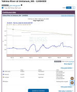
 water.noaa.gov

Could taking the time to initially use theI really liked the way the old page displayed. All gauges in the state displayed on one page with the latest cfs and gauge height. I could check all my favorite, or back when I was still working, all my personal project rivers in one minute. Now it takes over a minute to get the data I want for a single stream. It's way less user friendly to me this way. Also, I much preferred having gauges organized by watershed basin. Everyone knows that rivers pay no attention to county or state boundary lines. FFS, that's just a bad organizational idea.
Select for My favorites function (and every time you want to add a gauge) make it even faster than the old page for locating your favorite, or personal project rivers? And the My Favorites page is a separate bookmarkable URL.
It's almost as if every update be it government or Microsoft just brings an interior product that's more confusing to use. Leave it alone already. Windows 7 was fine. The old usgs site was great. I agree the new one sucks. I wonder what it cost us for the upgrade that's actually a downgrade?I think they finally killed that page. The new UI looks more "modern," but I personally preferred the old page. There are some cool things about the new page, and I'm still learning how it works, so I'll probably come around. I do like that once you figure out where your favorite stations are located on the map, you don't have to go to a new page to see the latest station data (just tap the dot). I also like that the default measurement unit is CFS, as opposed to gage height, which I generally find fairly useless.
USGS Washington Water Data
Too much, go get'em RoverI wonder what it cost us for the upgrade that's actually a downgrade?

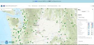
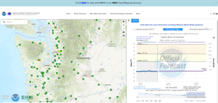
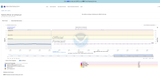
That appears to duplicate the same data and format as the NOAA National Water Prediction Service at a different URL than I showed above. Last year the NWPS replaced the NOAA American Hydrological Prediction Service I had used for years. If they are both NOAA sites I wonder if shutting one site down would save enough money to increase the number of gauges with Prediction capability?

I really liked the way the old page displayed. All gauges in the state displayed on one page with the latest cfs and gauge height. I could check all my favorite, or back when I was still working, all my personal project rivers in one minute. Now it takes over a minute to get the data I want for a single stream. It's way less user friendly to me this way. Also, I much preferred having gauges organized by watershed basin. Everyone knows that rivers pay no attention to county or state boundary lines. FFS, that's just a bad organizational idea.
Because it makes so much sense when a river has gauges in two or more counties, that a more advanced user prefers having to check multiple counties to get all the gauge readings on a single river? Fvck that! Sign me up for organizing by watershed and river basins, which is geographically and hydrologically logical, whereas counties are a human construct over layer.They set everything up for first time users because first time users complain the most. It’s amazing how much better an alphabetical list is than 90% of “user interfaces”.
I think they finally killed that page. The new UI looks more "modern," but I personally preferred the old page. There are some cool things about the new page, and I'm still learning how it works, so I'll probably come around. I do like that once you figure out where your favorite stations are located on the map, you don't have to go to a new page to see the latest station data (just tap the dot). I also like that the default measurement unit is CFS, as opposed to gage height, which I generally find fairly useless.
USGS Washington Water Data
The Favorites I saved did disappear from the from the new Washington water conditions landing page the following day without clearing cache and cookies.Unfortunately the favorites may disappear if I have to clear browser cache and cookies to fix wonky browser issues.
 waterdata.usgs.gov
