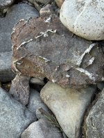
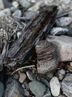
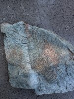
Just astounding!Maybe one day a gust of wind blew falling leaves into a lowland stream not very far from the coast. Downcurrent they drifted into an eddy, settled to the bottom, and were covered by silt. Time passed and as the offshore plate crashed into the continental plate over a hundred miles of land accreted to the west. What used to be the stream bed was thrust a mile skyward. And then, about 40 million years later, I wandered by.
Oregon's Blue Moutains.
View attachment 139853
Oregon's Blue Mountains.

Navigation
Install the app
How to install the app on iOS
Follow along with the video below to see how to install our site as a web app on your home screen.
Note: This feature may not be available in some browsers.
More options
Style variation
You are using an out of date browser. It may not display this or other websites correctly.
You should upgrade or use an alternative browser.
You should upgrade or use an alternative browser.
Rocks
- Thread starter SculpinSwinger
- Start date

Very Cool!
Looks like you could use a field guide with a localized focus like this.
View attachment 139864View attachment 139866
Also found this with a web search that seems to coincide with your general location and matches nicely with the book.
"Red agate can be found in Washington state, and is sometimes called carnelian. Carnelian is a solid red-orange chalcedony, while red agate is a banded chalcedony.
Locations
Lucas Creek: Located east of Chehalis
Salmon Creek: Located southeast of Toledo
Green Mt. Located in Kalama
Silver Lake: Located in Castle Rock
Valley C Ranch: Located in Tenino
Upper Toutle River: Located on the slopes of Mt. St. Helens
Damon Point State Park: Located in Grays Harbor
What is carnelian?
Carnelian is an orange gemstone that is not particularly rare, making it affordable
Larger, cleaner, and brighter reddish orange carnelian gemstones are more valuable
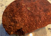
Looking at the book, the rust red stone on the left is probably Carnelian; solid red-orange chalcedony, possibly (I love) Jasper.
There are phone apps that allow you to snap a photo to make a match but my serious rockhounding brother doesn't find they work all that well. He prefers books containing identifying characteristics that can require high magnification and UV optics, and a hardness test kit.
Wow, thanks! Not that I need another rabbit hole, but it's apparent I need to get a tumbler setup.
Jasper came to mind but I'm starting to find out how much I don't know about rocks and geology in general. After watching the Nick Zentner YT Ancient Rivers of the Pacific Northwest (mind still blown) I'm wondering if any of these "red spuds" are the ones he talks about coming from the Salmon River. Same ones he picked up on top of Wallula Gap (again, mind blown)
Anyway, I will definitely be on the lookout for more Carnelian, and possibly petrified wood. A coworker lives on similar deposits near Green Mtn (Clark Co.) where the floods scoured Lacamas Lake. He brings in a wide variety of beautifully tumbled stuff, including some PW.
As for the red rocks, the larger broken one is very hard and has small crystalline inclusions. I'm sure it would polish nicely whether it is Jasper or something else.

Fourbtgait
Life of the Party
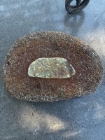
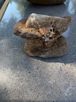
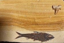
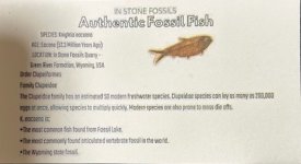
What I gave my wife for her birthday today.
Said it made her realize she isn’t so old.
Said it made her realize she isn’t so old.
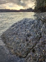
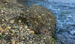
Interesting. Looks similar to this one, but more "fused". Not sure the correct geologic term for either, but "conglomoturd" seems to fit.

Last edited:

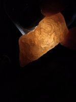
A few good glowy ones from the last couple days. 
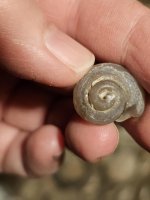
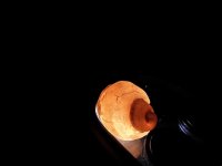
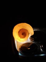
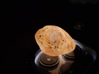
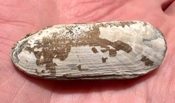
And a few good non-glowy ones…
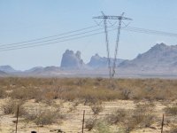
Lots of interesting roadside geology on a trip to Phoenix. Was tempted to stop and do some rock hounding, but just didn't have time. Not to mention my wife's fear of snakes ... which is rational concern in place like this.
Somewhere east of Joshua Tree NP.
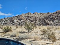
"Sheephole Valley Wilderness"
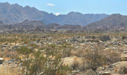
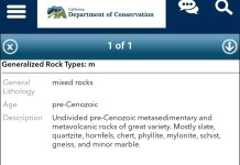
Route 177 just North of US 10. Was really tempted to stop here, based on the range of colors alone. A suspicion later supported when looking it up on an interactive geology map:
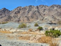
And whatever this other worldly formation is South of US 10 near Centennial AZ. Figured it had to be named or have some info, but nothing on Googly Maps or Earth. Guessing its an old volcanic plug?
Somewhere east of Joshua Tree NP.
"Sheephole Valley Wilderness"
Route 177 just North of US 10. Was really tempted to stop here, based on the range of colors alone. A suspicion later supported when looking it up on an interactive geology map:
And whatever this other worldly formation is South of US 10 near Centennial AZ. Figured it had to be named or have some info, but nothing on Googly Maps or Earth. Guessing its an old volcanic plug?
Last edited:
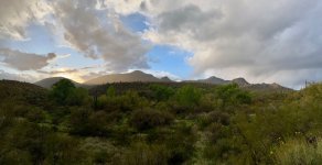
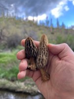
Thanks for sharing Guy. AZ has some good rock hounding from what I’ve heard. Last spring my partner and I went down there for a wedding. We took a day to look for fire agates but switched gears after coming up dry to look for our first AZ morels. Such a cool region. I need to get back there and spend some quality time exploring.Lots of interesting roadside geology on a trip to Phoenix. Was tempted to stop and do some rock hounding, but just didn't have time. Not to mention my wife's fear of snakes ... which is rational concern in place like this.
Somewhere east of Joshua Tree NP.
View attachment 144480
"Sheephole Valley Wilderness"
View attachment 144481
Route 177 just North of US 10. Was really tempted to stop here, based on the range of colors alone. A suspicion later supported when looking it up on an interactive geology map:
View attachment 144490
View attachment 144482
And whatever this other worldly formation is South of US 10 near Centennial AZ. Figured it had to be named or have some info, but nothing on Googly Maps or Earth. Guessing its an old volcanic plug?
View attachment 144483
Last edited:

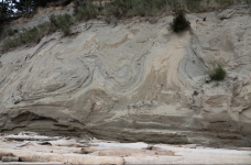
In the process of perhaps becoming rock.....what would explain the folds, looks like sedimentary layers above and below, but in the middle? Seen today on a beach bluff. I have my speculative version of it, curious if others have an explanation?
Obviously that’s just the imprint of a wave crashing into the cliff.In the process of perhaps becoming rock.....what would explain the folds, looks like sedimentary layers above and below, but in the middle? Seen today on a beach bluff. I have my speculative version of it, curious if others have an explanation?
View attachment 144619
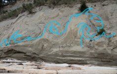

Liquefaction from an earthquake event, maybe?

The Columbia River Basalts covered an area of about 63,000 square miles of the Pacific NW between about 17 to 6-ish million years ago. The multiple floods of lava accumulated to a depth of up to 5900 feet. One outpouring, the Ginko Flow, originated north of Pasco and flowed 310 miles to present-day Newport, on the central Oregon coast, in about a week. (And people thought St Helens caused chaos!) I find all this just fascinating.
This went on for m/l 10 million years, but between floods of lava at any given point thousands, hundreds of thousands, or millions of years may have passed. That was sufficient time for flow surfaces to weather, break down, and become soil fertile enough to support vegetation. Grasses, shrubs and eventually trees would grow. Then another outpouring of basalt would flow in, immolating all that had grown and starting the process anew.
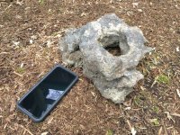
The last surface flow in what is now the Crooked River Scablands petered out north of the hamlet of Paulina, Oregon. The southern edge of the lavas is only inches deep in some places. Sufficient millenia had passed that a young forest had grown atop the last flow, but it, too perished as molten rock invaded the area and surrounded the trees. I stumbled onto that site while hunting decades ago. The slope is punctuated by dozens of shallow tree wells cast in the now-weathered lava. Today the site boasts cheatgrass, rabbitbrush, sage and junipers to about 12” dbh.
An example of a cast:
This went on for m/l 10 million years, but between floods of lava at any given point thousands, hundreds of thousands, or millions of years may have passed. That was sufficient time for flow surfaces to weather, break down, and become soil fertile enough to support vegetation. Grasses, shrubs and eventually trees would grow. Then another outpouring of basalt would flow in, immolating all that had grown and starting the process anew.
The last surface flow in what is now the Crooked River Scablands petered out north of the hamlet of Paulina, Oregon. The southern edge of the lavas is only inches deep in some places. Sufficient millenia had passed that a young forest had grown atop the last flow, but it, too perished as molten rock invaded the area and surrounded the trees. I stumbled onto that site while hunting decades ago. The slope is punctuated by dozens of shallow tree wells cast in the now-weathered lava. Today the site boasts cheatgrass, rabbitbrush, sage and junipers to about 12” dbh.
An example of a cast:
Last edited:
You might not be far off. Looks like an ice cream sandwich of sorts with normal horizontal strata above and below the wavy stuff. Wondering if this layer was laid down in a single event. Maybe a landslide, tsunami, or ... ?Obviously that’s just the imprint of a wave crashing into the cliff.
View attachment 144630
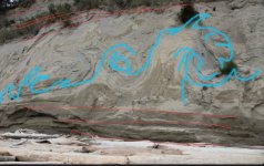

I love these swirl structures! You can see two different colors of sand and blueish clay in the cliff. These were deposited during successive periods of glaciation. The massive weight of the moving ice and the moving water at the base distorted the previous sand deposit producing the swirling interface.In the process of perhaps becoming rock.....what would explain the folds, looks like sedimentary layers above and below, but in the middle? Seen today on a beach bluff. I have my speculative version of it, curious if others have an explanation?
View attachment 144619
In some bluffs I've seen where the new glacier has actively ripped apart chunks of older glacial deposits and new sands and gravels are deposited in between the old material.
Other bluffs show evidence of interglacial lakes and running streams (thick gravel deposits), and even ancient trees or peat.
Earthquake faulting zones are even more extreme with large uplifts and sheering.
Hey I like that, seems reasonable. I was thinking another potential is the sand layers at the base are later covered with wind blown sand dunes, hence the way weirder angles, and that they could weather with a different kind of non-horizontal topography, they are then filled with still another layers of glacial silt or sand sand...I love these swirl structures! You can see two different colors of sand and blueish clay in the cliff. These were deposited during successive periods of glaciation. The massive weight of the moving ice and the moving water at the base distorted the previous sand deposit producing the swirling interface.
In some bluffs I've seen where the new glacier has actively ripped apart chunks of older glacial deposits and new sands and gravels are deposited in between the old material.
Other bluffs show evidence of interglacial lakes and running streams (thick gravel deposits), and even ancient trees or peat.
Earthquake faulting zones are even more extreme with large uplifts and sheering.
I like the idea that the sand that looks wavy might have been the "grease" or the buckled front or side edge of sandy moraine beneath an ice sheet though.

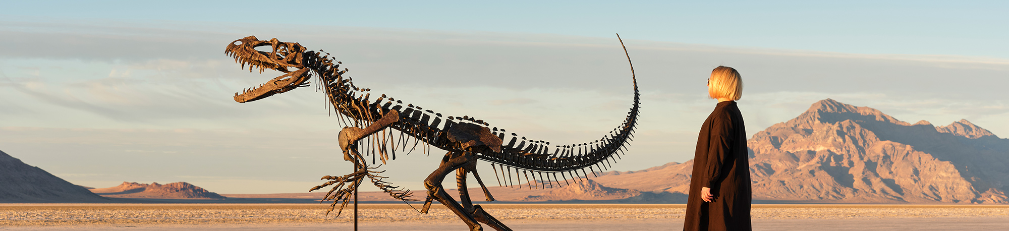
This auction has some amazing (and amazingly expensive) fossils, minerals, and meteorites:
 www.sothebys.com
Natural History, Including The Juvenile Ceratosaurus, and the Largest Piece of Mars on Earth | Science | Sotheby's
This year’s Natural History sale will feature a carefully curated selection of dinosaur and non-dinosaur fossils, meteorites, and minerals alongside other natural wonders. Building upon last year’s success, we will also be offering tools and artwork from our Paleolithic and Neolithic human...
www.sothebys.com
Fourbtgait
Life of the Party
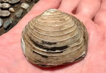
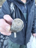
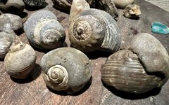
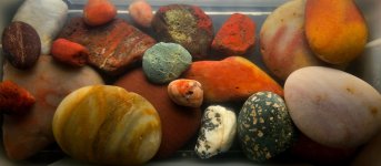
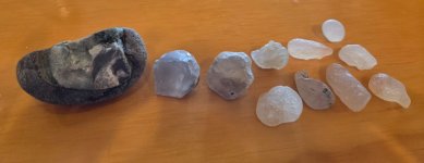
Curious rocks on our fishing trip.