
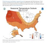
Some rain but it doesn’t look exceptionally wet to me on the westside heading into Junuary. Hopefully that is just rain and not lightning for the eastside this coming week.
SF
SF

Follow along with the video below to see how to install our site as a web app on your home screen.
Note: This feature may not be available in some browsers.

Had nothing to do with "long-range forecasting", had everything to do with lack snowpack and SWE available to keep reservoirs full beyond May. Those who looked at those data points and didn't just trust the naysaying of a particular blogger demonstrated some critical thinking.If you call long range forecasting "Critical thinking". When the local paper, youtubers and DOE, state the sky is falling the 1st of April before the rains are complete, there needs to be some criticism of the accuracy of the reporting. I don't put too much faith in the science of long range forecasting. A crap shoot at best. Especially here in the PNW. In western WA, we still could have a gloomy June. The 4th of July pyro's, irresponsible campers and the fires that result, are the ones who need to be reeled in.

Or perhaps the regulators of Cushman did not retain as much of the ample December-April precipitation (look at the chart) due to legally required water releases. In that case the low snowpack hits harder at Cushman than is the case at other reservoir systems not required to have substantial water releases prior to the May-July melt period.Had nothing to do with "long-range forecasting", had everything to do with lack snowpack and SWE available to keep reservoirs full beyond May. Those who looked at those data points and didn't just trust the naysaying of a particular blogger demonstrated some critical thinking.
Not just Cushman, going to be in issue with most other east side reservoirs that aren't fed by the Cascadian Aquifer. Reservoirs may have been full in late April/early May, but with scheduled and mandated drawdowns for irrigation, there hasn't been the snowpack/SWE, which normally would continue replenishing those reservoirs through May and into June, to help keep them full even after the drawdowns start.Or perhaps the regulators of Cushman did not retain as much of the ample December-April precipitation (look at the chart) due to legally required water releases. In that case the low snowpack hits harder at Cushman than is the case at other reservoir systems not required to have substantial water releases prior to the May-July melt period.

If you call long range forecasting "Critical thinking". When the local paper, youtubers and DOE, state the sky is falling the 1st of April before the rains are complete, there needs to be some criticism of the accuracy of the reporting. I don't put too much faith in the science of long range forecasting. A crap shoot at best. Especially here in the PNW. In western WA, we still could have a gloomy June. The 4th of July pyro's, irresponsible campers and the fires that result, are the ones who need to be reeled in.


 www.newsbreak.com
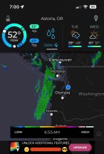
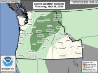
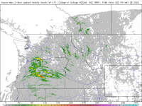
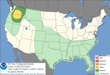
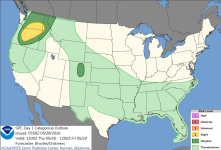
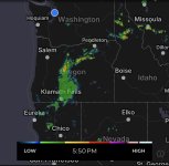
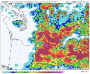
Looks like Idaho panhandle as well as eastern Oregon and Washington might get some active weather on Thursday. Hopefully it’s nothing severe.
SF


 ktvz.com
but I can smell it.

I can feel it in my knees!!!!Tom,
You are showing your true PNW roots!
SF


