

Navigation
Install the app
How to install the app on iOS
Follow along with the video below to see how to install our site as a web app on your home screen.
Note: This feature may not be available in some browsers.
More options
Style variation
You are using an out of date browser. It may not display this or other websites correctly.
You should upgrade or use an alternative browser.
You should upgrade or use an alternative browser.
Rain
- Thread starter Stonedfish
- Start date




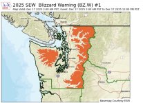
Heads up! How devastating enough to have to leave (evacuate) your home and then these asshats show up.
 www.king5.com
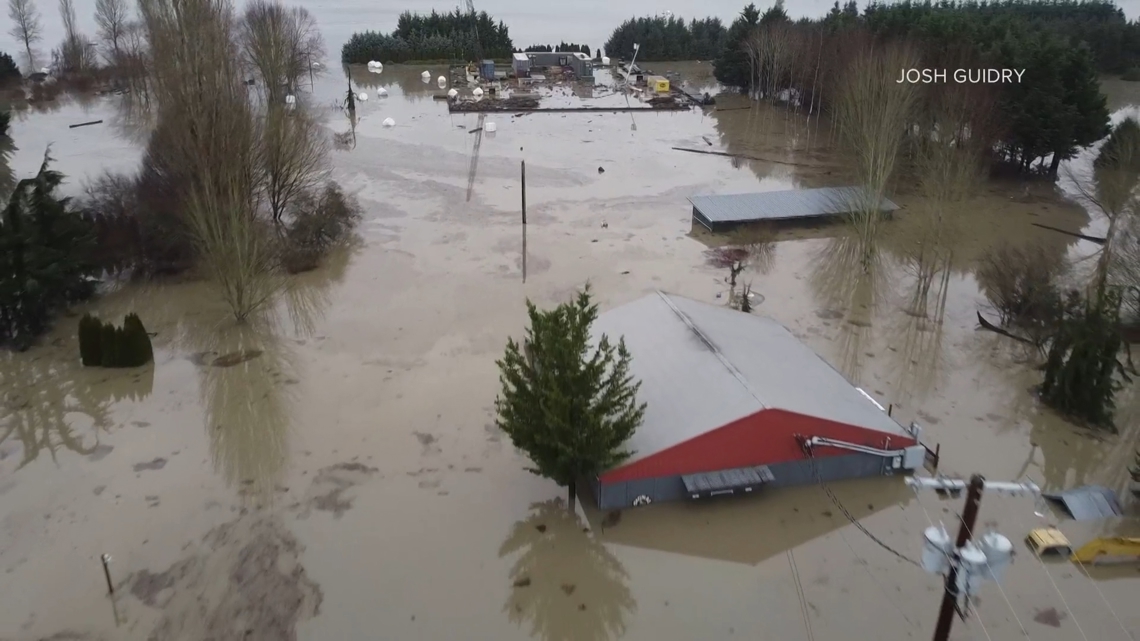
Looters in kayaks target flooded Snohomish farm as historic flooding continues
The rising waters have brought more than just sightseers. The Snohomish County Sheriff's Office said looters have taken to kayaks to steal from flooded properties.
www.king5.com


Since the backhoe is busy patching levee breaches, and because the punishment should fit the crime, I think we should keel haul the looters. Keel haul through the mix of floodwater and cow manure; that'll fix 'em!Or get @Salmo_g to warm up this backhoe….
SF

We lost power last night for about 2.5 hours around at ~01:56.
From my email notifcations today apparently internet and even cell comms were sketchy for about another 2 hrs.
Last night at 01:55 the wind at a NOAA reporting station close to me showed W 28 G 47
There is a 5 acre stand of Doug Firs bordering us on the south.
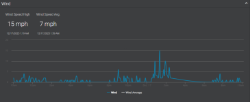
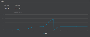
Over the last 24 hrs our weather station at 15' above the ground registered
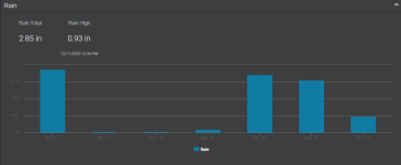
Rainfall over the last 7 days
From my email notifcations today apparently internet and even cell comms were sketchy for about another 2 hrs.
Last night at 01:55 the wind at a NOAA reporting station close to me showed W 28 G 47
There is a 5 acre stand of Doug Firs bordering us on the south.
Over the last 24 hrs our weather station at 15' above the ground registered
Rainfall over the last 7 days
Last edited:
Cold front came through around 1am, some thunder and lightning, wind gauge went crazy. Area had trees falling on power lines (mine is underground through the property). I lost the internet for 15 minutes. Still people are out of power, expecting the downpour later. So far only 0.20 on the weather station.


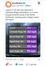
"The lighthouse at North Head, on 29 January 1921, sustained winds reached 113 mph with gust estimated to 150 mph occurred at this site, the strongest winds ever observed over Washington State. Extraordinary damage occurred over much of coastal Washington during this event."
On Sept 30 2013 a Level EF-1 tornado touched down at 7:20 a.m. The twister, whose winds reached 110 mph, was 75 yards wide and left behind damage estimated at $25,000 less than a mile from us.
Being a Native Washingtonian I was surprised to learn when attending a FEMA-sponsored ECOM seminar in 2017 that Washington averages between two to three tornadoes per year.

Last edited:
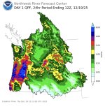
Is that map precipitation or river levels?
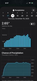
There appears to be quite a difference with the map and the NOAA forecast today & tomorrow where I am at near S Sound?
@Home, WA - 400 ft Today, Dec 18, 2025
53° F
100%
Rain. High near 53. South southwest wind 9 to 18 mph, with gusts as high as 46 mph. Chance of precipitation is 100%. New precipitation amounts between a tenth and quarter of an inch possible.
@Home, WA - 400 ft Friday, Dec 19, 2025
43° F
90%
Rain. High near 43. Southwest wind 6 to 11 mph, with gusts as high as 20 mph. Chance of precipitation is 90%. New precipitation amounts between a tenth and quarter of an inch possible.
Precipitation….
This system today is going to affect Oregon much more so than Washington.
SF
Last edited:
When I looked at the map on my phone I misread the tiny numbers with my tired old eyes.Precipitation….
This system today is going to affect Oregon much so more than Washington.
SF
After I got on my laptop I could see the forecast and see the map is accurate for my location

When I was in boot camp a storm came through one night at O-early thirty. The wind blew out a window in the barracks near my rackI remember a few tornadoes in the Vancouver/Battleground area. The major one was in 1971 when I was working in a building 10 stories up in downtown Portland with skinny windows that went from floor to ceiling. They did a bunch of flexing....
. Those who had been through those types of storms immediately opened a few windows on both the windward and lee side of the barracks apparently to equalize the pressure. We had a bit of clean up to do the following morning before mess.