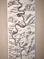
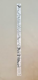
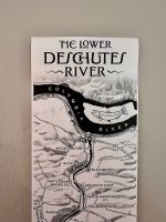
Hey everyone! We did a fun thing I wanted to let you know about: A pocket-sized "ribbon map" of the Lower Deschutes benefitting the Deschutes River Alliance.
The "ribbon" style of map was originally popular with riverboat captains on rivers like the Mississippi, where they'd have this big scroll that they would move along with the boat, which would provide a constant contextual update for the terrain etc.
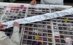
A cartographer buddy was doing these (for the Wakulla and Suwanee in the SE, and the Boston Marathon) and I thought, huh, maybe we could do one of these for the Deschutes, but make it more durable. So I sourced the material (really similar to the WA license material, slightly less thick) and the printer, and we set out to design one and bring this thing into the world.
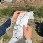
It's got all the big rapids, campsites, and a few historic spots on the Lower river, and plenty of space for you to mark all your fave areas, fish caught, birds spotted, etc. Part of the rationale was wanting something analog (e.g. not an app) to be able to jot down river memories.
We've had a lot of positive feedback and enthusiasm about this already, and folks who have been sharing ideas and other things we can do with this format. I'd love to know whether there are other rivers / foundations that spring to mind to partner with. I'm also trying to figure out how to make a low-cost raft / DB mount, so it can be used as you go down the river. I think there's probably a way to 3D print something.
Anyway, it's been a fun way to help folks make the river feel more personal to them, by helping them build their own little treasure map.
There's a fun little launch video, more on the project here if you're interested, and a deep dive on the cartography process.
The "ribbon" style of map was originally popular with riverboat captains on rivers like the Mississippi, where they'd have this big scroll that they would move along with the boat, which would provide a constant contextual update for the terrain etc.
A cartographer buddy was doing these (for the Wakulla and Suwanee in the SE, and the Boston Marathon) and I thought, huh, maybe we could do one of these for the Deschutes, but make it more durable. So I sourced the material (really similar to the WA license material, slightly less thick) and the printer, and we set out to design one and bring this thing into the world.
It's got all the big rapids, campsites, and a few historic spots on the Lower river, and plenty of space for you to mark all your fave areas, fish caught, birds spotted, etc. Part of the rationale was wanting something analog (e.g. not an app) to be able to jot down river memories.
We've had a lot of positive feedback and enthusiasm about this already, and folks who have been sharing ideas and other things we can do with this format. I'd love to know whether there are other rivers / foundations that spring to mind to partner with. I'm also trying to figure out how to make a low-cost raft / DB mount, so it can be used as you go down the river. I think there's probably a way to 3D print something.
Anyway, it's been a fun way to help folks make the river feel more personal to them, by helping them build their own little treasure map.
There's a fun little launch video, more on the project here if you're interested, and a deep dive on the cartography process.