
It began about 20 years ago with day hikes on my first visit to southern Utah. Maybe it's the dramatic contrast with my native PNW, but for whatever reason, the SW desert country has taken a hold on me. I thought it would be fun to go backpacking in the desert canyon country, but having long ago read Edward Abbey's Desert Solitaire, I'm mildly paranoid about having water while hiking in the desert. One area I keep coming back to is the Grand Staircase Escalante National Monument. It's 200 million acres of desert wilderness canyons and plateaus, full of slot canyons, cliffs, hoo doos, arches, natural bridges - what I often refer to as a geological freak show.
Four years ago, in 2022 my oldest daughter and I signed up with an outfitter for a group hike in the area, largely to alleviate my paranoia regarding water. She liked it so well that she's gone back each spring since, doing more aggressive canyoneering style trips that include rapelling into water filled slot canyons and wading or swimming out. Much as I'd love to do that kind of trekking also, I'm smart enough to know that window of experience has closed for me. I'm sticking to scrambling and mild boulder hopping, along with some off-trail route finding. I solo hiked in 2023 into Coyote Gulch, a well known hike that has a perennial stream, so water supply is assured.
I signed up again this spring to join a group hike in the Escalante area. I admit that I like having a guide when I don't know where the water is. This was a fun group that I dubbed "Team Geritol." You'd have to be of a certain age to have any idea what that means. The youngest person in the group was a 64 year old woman from Kansas. Like my last group hike, I was again the oldest, this time at 77. In addition to Kansas, I met hikers from Connecticut, Ohio, Iowa, and Oregon. Our route included the larger part of a route that has interested me for the past year or so, the old Boulder Mail Trail, an actual historical route through the mountains over which mail was hauled, on a mule or donkey, I suppose, between the towns of Escalante and Boulder, UT.
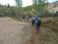
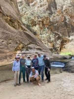
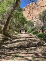
Here's Team Geritol just starting out:
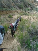
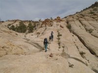
Sometimes uphill,
The route sometimes marked by cairns, as seen on the right of this photo:
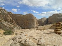
Strange rock formations are normal around these parts:
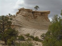
Mild climbing was involved:
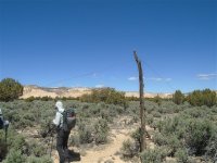
An old telegraph wire remains as evidence of this old mail route:
To be continued . . .
Four years ago, in 2022 my oldest daughter and I signed up with an outfitter for a group hike in the area, largely to alleviate my paranoia regarding water. She liked it so well that she's gone back each spring since, doing more aggressive canyoneering style trips that include rapelling into water filled slot canyons and wading or swimming out. Much as I'd love to do that kind of trekking also, I'm smart enough to know that window of experience has closed for me. I'm sticking to scrambling and mild boulder hopping, along with some off-trail route finding. I solo hiked in 2023 into Coyote Gulch, a well known hike that has a perennial stream, so water supply is assured.
I signed up again this spring to join a group hike in the Escalante area. I admit that I like having a guide when I don't know where the water is. This was a fun group that I dubbed "Team Geritol." You'd have to be of a certain age to have any idea what that means. The youngest person in the group was a 64 year old woman from Kansas. Like my last group hike, I was again the oldest, this time at 77. In addition to Kansas, I met hikers from Connecticut, Ohio, Iowa, and Oregon. Our route included the larger part of a route that has interested me for the past year or so, the old Boulder Mail Trail, an actual historical route through the mountains over which mail was hauled, on a mule or donkey, I suppose, between the towns of Escalante and Boulder, UT.
Here's Team Geritol just starting out:
Sometimes uphill,
The route sometimes marked by cairns, as seen on the right of this photo:
Strange rock formations are normal around these parts:
Mild climbing was involved:
An old telegraph wire remains as evidence of this old mail route:
To be continued . . .



 . 9K cfs is not ideal conditions, I’ve been told around 4K is ideal and never had much luck after a flow bump so you did well. Egg bite in September- October is good with lower flows and wadeable around Sundial bridge and other locations.