
I was last up this way 21 years ago... it seemed much easier then. That was before it became Instagram famous and we saw one other person the whole trip. Ah, the good ol' days.
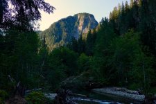
We got a late start and hiked the first section in the afternoon. You gain about 1200' to net 600' over 4.5 miles. We camped by the river just before the trail turns right and heads uphill past this feature.
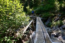
The trail is fairly steep and rough, and it was too warm for comfort. The Trailblazers have built a few structures including this nice log bridge.
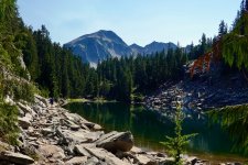
Eventually you top out at the first of several lakes. A number of these, including this one, are on the WDFW Overabundant Lakes list.
There was a nice log cabin. Again, built by the Trailblazers in 1950; now run down and a bit trashed. Still lots of ripe berries up here.
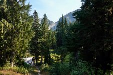
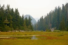
We were feeling pretty beat, and decided to stop for the night; the next day we planned to gain another 1200' which gets you to an alpine upland with open views and some interesting lakes to explore. We found a fairly nice, though dusty camp spot overlooking the meadowy head of the second lake.
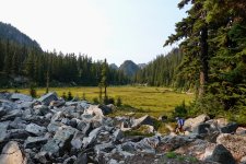
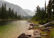
After dinner I hung out on a rock ledge overlooking the lake, watching fish rise. The fish have plenty of spawning habitat and are plentiful though small. I was in no hurry to bother them. There was definitely a smoke layer higher above, but I thought we were far enough away from active fires not to be concerned. I saw a Plover type bird which I've never encountered before in the high country, but didn't get a good enough look to attempt an ID.
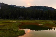
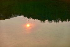
About a minute after taking this picture, I heard a loud splash 50' to my right, and was surprised to see someone's large black dog paddling about. Usually we'll hear hikers approaching from some distance. As is my habit, I started talking to the pup; "Hey doggie, how'z it going?"
OH WAIT, THAT'S A BEAR!!
I really wish I'd gotten a picture, but we were both so surprised that the bear took off before I even had time to think about it. 'Good sized specimen from what I can tell. I made sure to hang our Ursack extra far from camp that night.
We woke the next day to Yuck, which rhymes with _ _ _ _. The smoke had blown in thickly, and we had waves of hot, ash laden air occasionally waft through. My wife knows way too much, including the fact that this is not healthy. I knew we were headed out.
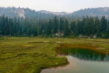
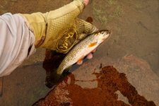
We did spend a few hours wandering around the lake we camped by, and I stopped to string up the fly rod. A size 14 Adams was eagerly consumed. I saw a Kingfisher; again- not something I'm used to in the high country.
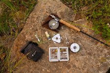
This is my backpacking kit: a TFO six piece rod, some cheapo reel : ) , a nice little belt pouch that Z-Packs used to make, a C&F fly box held together with duct tape, a 9' sink tip, 4x, 5x, 6x, nippers, flotant, and a roach clip. It all weighs 18.4 oz.
A bit more sightseeing, a last cup of tea, and we headed out.
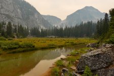
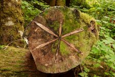
I fished the lowest lake but wasn't really into it, and the fish were just playing chicken with my fly. My knees were not super happy with the rough downhill. Were it not for trekking poles, I'd have suffered greatly. We found some choice mushrooms in the valley and passed this cool cut log.
Out before dark, chips and Limonata waiting in the car. I'm already thinking I might just go back.
We got a late start and hiked the first section in the afternoon. You gain about 1200' to net 600' over 4.5 miles. We camped by the river just before the trail turns right and heads uphill past this feature.
The trail is fairly steep and rough, and it was too warm for comfort. The Trailblazers have built a few structures including this nice log bridge.
Eventually you top out at the first of several lakes. A number of these, including this one, are on the WDFW Overabundant Lakes list.
There was a nice log cabin. Again, built by the Trailblazers in 1950; now run down and a bit trashed. Still lots of ripe berries up here.
We were feeling pretty beat, and decided to stop for the night; the next day we planned to gain another 1200' which gets you to an alpine upland with open views and some interesting lakes to explore. We found a fairly nice, though dusty camp spot overlooking the meadowy head of the second lake.
After dinner I hung out on a rock ledge overlooking the lake, watching fish rise. The fish have plenty of spawning habitat and are plentiful though small. I was in no hurry to bother them. There was definitely a smoke layer higher above, but I thought we were far enough away from active fires not to be concerned. I saw a Plover type bird which I've never encountered before in the high country, but didn't get a good enough look to attempt an ID.
About a minute after taking this picture, I heard a loud splash 50' to my right, and was surprised to see someone's large black dog paddling about. Usually we'll hear hikers approaching from some distance. As is my habit, I started talking to the pup; "Hey doggie, how'z it going?"
OH WAIT, THAT'S A BEAR!!
I really wish I'd gotten a picture, but we were both so surprised that the bear took off before I even had time to think about it. 'Good sized specimen from what I can tell. I made sure to hang our Ursack extra far from camp that night.
We woke the next day to Yuck, which rhymes with _ _ _ _. The smoke had blown in thickly, and we had waves of hot, ash laden air occasionally waft through. My wife knows way too much, including the fact that this is not healthy. I knew we were headed out.
We did spend a few hours wandering around the lake we camped by, and I stopped to string up the fly rod. A size 14 Adams was eagerly consumed. I saw a Kingfisher; again- not something I'm used to in the high country.
This is my backpacking kit: a TFO six piece rod, some cheapo reel : ) , a nice little belt pouch that Z-Packs used to make, a C&F fly box held together with duct tape, a 9' sink tip, 4x, 5x, 6x, nippers, flotant, and a roach clip. It all weighs 18.4 oz.
A bit more sightseeing, a last cup of tea, and we headed out.
I fished the lowest lake but wasn't really into it, and the fish were just playing chicken with my fly. My knees were not super happy with the rough downhill. Were it not for trekking poles, I'd have suffered greatly. We found some choice mushrooms in the valley and passed this cool cut log.
Out before dark, chips and Limonata waiting in the car. I'm already thinking I might just go back.
Last edited:

 I like the Battenkills for hiking because they are fairly lightweight and you can easily carry an extra floating line and sinking line spool to go with the intermediate spool.

 I've created a waypoint with that label in my Gaia acct and hence, it shall remain so until my brother and I are gone.

