

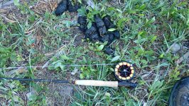
Made my final Firehole Foray of Spring Thursday morning. Afternoon water temps are already hitting the mid-70s, so the river is cooked until mid-September. This morning was a lesson in contrasts. The river is down to about normal and crystal clear. I arrived at my favorite reach around 0530 and broke out the 4 weight with a bugger soft hackle combo. It was a cloudless night and no bugs about at dawn as the air temp was 33 degrees. Fought ice in the guides for bit before the sun hit the meadow. For the second trip in a row, bear sign greeted me as I walked to the river. A large, obvious pile of grizzly scat graced the path through a stand of trees. Head on a swivel time again. As I fished through the reach, the fish were active, and a lot of hookups resulted on the soft hackle trailer. By 0930, air temps were in the 60s and some major emergences going on with both caddis and mayflies. The river revealed its bounty at every turn.
Unfortunately, once the river starts boiling like this the old soft hackle is less effective and more fish hit the bugger which must seem irresistible as it swings through the rising fish.
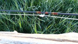
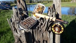
Firehole ammunition
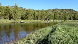
I call this particular stretch of river Pucker Butt Bend. It is the farthest from the road and the deep outside bend butts up against a heavy stand of Lodgepole pine. On more than one occasion while fishing this stretch, a bull bison, a bull elk or coyote has barreled out the woods in front of me. Given the grizzly scat sign, I am always nervous as I fish this corner.
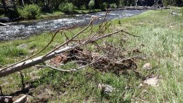
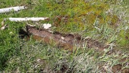
I left the river about 10AM and headed for a tributary of the Madison that takes a little hiking to get to. I really wanted to see what the flooding might have done a few weeks ago. The stream was pretty much at normal flows for late June and still held a lot of fish. But the flood had done some rearranging. Some old log jams were gone, and new ones created. My guess from the debris alongside the river that the flows reached 4-5’ above the current level. Some previously undercut, grass banks were now scoured. It will take many seasons before they are undercut again. One of the most intriguing effects of the flooding was the removal of downed logs, deeply buried in the grassy shoreline—probably there since fires swept through this part of the park at some point.
There was good news online when I got home as YNP will open the North Loop road on July 2 and do away with the ALS system. The Lamar fisheries will still be inaccessible, but the Gardiner (lower) will be accessible on foot and Gardiner (near Mammoth and above the falls) will be accessible from Norris or Tower. At Tower, the Yellowstone should be accessible. And at Canyon, the Cascade Lake trail should be accessible (good summer cutt fishery). Another decent day on the water.
Unfortunately, once the river starts boiling like this the old soft hackle is less effective and more fish hit the bugger which must seem irresistible as it swings through the rising fish.
Firehole ammunition
I call this particular stretch of river Pucker Butt Bend. It is the farthest from the road and the deep outside bend butts up against a heavy stand of Lodgepole pine. On more than one occasion while fishing this stretch, a bull bison, a bull elk or coyote has barreled out the woods in front of me. Given the grizzly scat sign, I am always nervous as I fish this corner.
I left the river about 10AM and headed for a tributary of the Madison that takes a little hiking to get to. I really wanted to see what the flooding might have done a few weeks ago. The stream was pretty much at normal flows for late June and still held a lot of fish. But the flood had done some rearranging. Some old log jams were gone, and new ones created. My guess from the debris alongside the river that the flows reached 4-5’ above the current level. Some previously undercut, grass banks were now scoured. It will take many seasons before they are undercut again. One of the most intriguing effects of the flooding was the removal of downed logs, deeply buried in the grassy shoreline—probably there since fires swept through this part of the park at some point.
There was good news online when I got home as YNP will open the North Loop road on July 2 and do away with the ALS system. The Lamar fisheries will still be inaccessible, but the Gardiner (lower) will be accessible on foot and Gardiner (near Mammoth and above the falls) will be accessible from Norris or Tower. At Tower, the Yellowstone should be accessible. And at Canyon, the Cascade Lake trail should be accessible (good summer cutt fishery). Another decent day on the water.
Last edited:
