Yakima River

Brian Miller

Be vewy vewy quiet, I'm hunting Cutthwoat Twout
Forum Supporter
Feel free to post observations of dangerous conditions such as hazards to navigation and how to avoid them.
PM me if you'd like to add gauge sites
easw1_hg.png


yumw1_hg.png


hlkw1_hg.png


umtw1_hg.png


USGS gauge page includes useful prior year & median levels
 
Are there optimum/ideal levels for floating at each station?
Hello @rooftop .
I am hoping that someone with much more knowledge and experience than I have will answer.
Most of the CFS data about the Yakima is for wading and tubing. And most of that data is for the easier Lower Canyon-Wilson Creek to Roza reach.
I think a more important question from Easton to Wilson Creek is the latest information on hazards and blocked channels.
A trip to a fly shop for up to date information might be the best way to get this information. And if you find out, please post it below.


Here is the "latest" from American Whitewater
Yakima Confluence with Teanaway River to Thorp
Yakima River Ellensburg to Roza Dam (Yakima Canyon)


Here is data about the Lower Canyon to Roza from Red's:
 
New: live conditions for the Upper Yakima & Farmlands

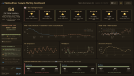
I just added fishing info and live conditions for two more stretches of the Yakima — the Upper Reach (Cle Elum area) and the Farmlands.

A quick note on the data: some metrics, like water temperature, don't have a gauge at every location. For those, I built a model to estimate them — and I didn't just trust the math. I spent several days actually wading in and taking real temperature readings at the river to check the model against reality. It's holding up accurate to within about a degree.

I'll recalibrate in the fall as the weather turns, to make sure the models stay reliable through the seasonal change.

Hope some of you find it useful. Tight lines.
 
Back
Top