Plan A: A couple buddies and I we were going up to explore a lake with some pretty special fish in it. It's not a well known hike, and there's a few stream crossings and about half of it is off trail, but the reward was going to be epic. But.....after hiking in a bout half way on Friday afternoon we got to the first big stream crossing and the creek was raging. Way too deep and too swift for us to try and cross without risking too much (there's a series of 6' - 8' drops every 15', so one bad step and you're going down real quick). Wasn't worth it - so we scrambled about 1/2 mile up the ravine gaining about 800' looking for a better crossing, but couldn't find anything. After some debate, the three of us decided it would be best to head back and come up with a plan B. Plan A was officially scrapped. It wasn't all for not though, it was a fun hike and we learned some good info on a hike that I'll definitely be going back to in the near future. @Phil K I'll PM you some details - I think you'll be interested.
Anyway, we made it back to the truck right about dark feeling a bit rejected, but still in relatively good spirits. It was late thought and we had two goals: food and a place to sleep. We found food pretty quickly, a nice watering hole that was still open not too far from the trailhead. They served us up some cold beers and nachos and allowed us enough time to spread open a map and use there wifi to download maps and solidify a plan B.
Plan B: disclaimer - we came up with this plan while sitting at a bar eating nachos and drinking beer - we had just been rejected off our plan A and were a bit hurried. It was late and we were trying to find a place to stay and a hike that we could pull off on short notice (it was 10PM). We found a spot that looked good, so we headed to the trailhead. Got there about 10:30 and slept in the truck. When we woke up, we realized we were in a national park and needed backcountry permits (sign at the trailhead). We didn't know how many campsites there were, but we counted cars - there were 5 rigs at the trailhead.....hmmmmm, guess we're heading back down the hill to the ranger station to see if we can get some permits....
Pulled into the ranger station and the lot was full, and the line was long. Shit. We grabbed a number (we were number 07). They were serving number 92.....no biggie, maybe it goes quick? We watched for fifteen minutes as they processed a single customer. Not wanting to wait around for an hour and half to see if we could get a permit, we opened up the map and looked for a plan C. Found a spot on a nearby drainage that looked like a good hike; quick hike up to two lakes with the option to keep going up to another two lakes. Had a quick group discussion and decided to bail on Plan B and officially we were on to Plan C.
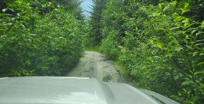
Plan C: at this point we had gone from super stoked for plan A, to bailing on plan B to Plan C. Stoke was lower and morale was a bit in the dumps. That's before we got to the road into the trail head. It was a bout a 2 hour drive down a narrow (one lane) road with a ton of sketchy blind corners and a lot of pot holes. This road was not kind to the paint job on the truck. At this point though, we weren't going to let a road stop us.
But....good thing about roads like this is that they aren't for the casual weekend warrior. When we got to the trailhead, we weren't surprised to see we were the only ones there - hell yes.
Off we went, Plan C was happening. We got up to the first lake and decided to keep going, even though it looked fishy.
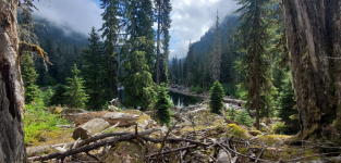
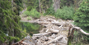
The trail around the lake was a bit hit and miss. Cool little lake though.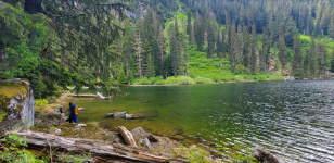
We got around the second lake and found a great spot to take a break and grab a quick bite at the inlet. Some beautiful westlopes who were also voraciously feeding - fun on a 4wt and a dry fly. Plan C was starting to feel good.
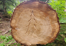
We were really lucky in that it looked like the trail crew had been up there (for the first time in a long time) really recently. There were a TON of downed trees across the trail and they all had fresh steps cut in them. From the second lake up, the downed trees were everywhere.
The trail vanished on us after crossing a stream on a sketchy log, but someone had flagged a route with ribbon, so up we went following the ribbons. It was steep and the flags were spaced far enough apart that we had to keep an eye out, but we did fine finding our way thru up to where the trail finally picked up again.
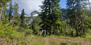
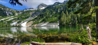
Finally at the upper lakes, fish were rising, water was clear, the sun was out and there was nobody else around - stoke was high. Plan C was feeling really good.
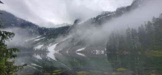
Clouds came in that night and the next day was cooler - but still, nobody was complaining.
Our camp setup was pretty sweet - great spot to shoot off and explore from.
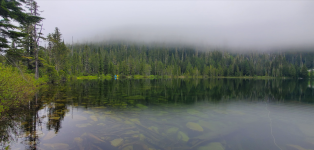
Fishing was hit and miss, when the sun came out it was great, but wind would kick up periodically and/or the clouds would cool things off and the action kind of shut off like a light switch. Regardless, it was pretty fun sight fishing to cruising westlopes. This lake isn't stocked, so this I believe is a naturally sustaining population.
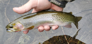
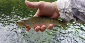
Best fish of the trip was this 19" stud. We long line released another in the same size class.
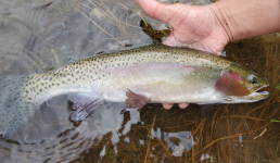
Eventually it came time to head back home. We packed up and made our way down and stopped at the lower lake and caught a few more westslopes at the inlet and eventually made our way back down the long road home to put a bow on our 19.9 miles of weekend fun. All in all, bummed that Plan A didn't work out, but Plan C ended up being pretty sweet. I'm thinking I'll come back here some time.
Anyway, we made it back to the truck right about dark feeling a bit rejected, but still in relatively good spirits. It was late thought and we had two goals: food and a place to sleep. We found food pretty quickly, a nice watering hole that was still open not too far from the trailhead. They served us up some cold beers and nachos and allowed us enough time to spread open a map and use there wifi to download maps and solidify a plan B.
Plan B: disclaimer - we came up with this plan while sitting at a bar eating nachos and drinking beer - we had just been rejected off our plan A and were a bit hurried. It was late and we were trying to find a place to stay and a hike that we could pull off on short notice (it was 10PM). We found a spot that looked good, so we headed to the trailhead. Got there about 10:30 and slept in the truck. When we woke up, we realized we were in a national park and needed backcountry permits (sign at the trailhead). We didn't know how many campsites there were, but we counted cars - there were 5 rigs at the trailhead.....hmmmmm, guess we're heading back down the hill to the ranger station to see if we can get some permits....
Pulled into the ranger station and the lot was full, and the line was long. Shit. We grabbed a number (we were number 07). They were serving number 92.....no biggie, maybe it goes quick? We watched for fifteen minutes as they processed a single customer. Not wanting to wait around for an hour and half to see if we could get a permit, we opened up the map and looked for a plan C. Found a spot on a nearby drainage that looked like a good hike; quick hike up to two lakes with the option to keep going up to another two lakes. Had a quick group discussion and decided to bail on Plan B and officially we were on to Plan C.
Plan C: at this point we had gone from super stoked for plan A, to bailing on plan B to Plan C. Stoke was lower and morale was a bit in the dumps. That's before we got to the road into the trail head. It was a bout a 2 hour drive down a narrow (one lane) road with a ton of sketchy blind corners and a lot of pot holes. This road was not kind to the paint job on the truck. At this point though, we weren't going to let a road stop us.
But....good thing about roads like this is that they aren't for the casual weekend warrior. When we got to the trailhead, we weren't surprised to see we were the only ones there - hell yes.
Off we went, Plan C was happening. We got up to the first lake and decided to keep going, even though it looked fishy.
The trail around the lake was a bit hit and miss. Cool little lake though.
We got around the second lake and found a great spot to take a break and grab a quick bite at the inlet. Some beautiful westlopes who were also voraciously feeding - fun on a 4wt and a dry fly. Plan C was starting to feel good.
We were really lucky in that it looked like the trail crew had been up there (for the first time in a long time) really recently. There were a TON of downed trees across the trail and they all had fresh steps cut in them. From the second lake up, the downed trees were everywhere.
The trail vanished on us after crossing a stream on a sketchy log, but someone had flagged a route with ribbon, so up we went following the ribbons. It was steep and the flags were spaced far enough apart that we had to keep an eye out, but we did fine finding our way thru up to where the trail finally picked up again.
Finally at the upper lakes, fish were rising, water was clear, the sun was out and there was nobody else around - stoke was high. Plan C was feeling really good.
Clouds came in that night and the next day was cooler - but still, nobody was complaining.
Our camp setup was pretty sweet - great spot to shoot off and explore from.
Fishing was hit and miss, when the sun came out it was great, but wind would kick up periodically and/or the clouds would cool things off and the action kind of shut off like a light switch. Regardless, it was pretty fun sight fishing to cruising westlopes. This lake isn't stocked, so this I believe is a naturally sustaining population.
Best fish of the trip was this 19" stud. We long line released another in the same size class.
Eventually it came time to head back home. We packed up and made our way down and stopped at the lower lake and caught a few more westslopes at the inlet and eventually made our way back down the long road home to put a bow on our 19.9 miles of weekend fun. All in all, bummed that Plan A didn't work out, but Plan C ended up being pretty sweet. I'm thinking I'll come back here some time.